

A new environmental intelligence tool for Cornwall and the Isles of Scilly will help protect the region’s precious wildlife and landscape.
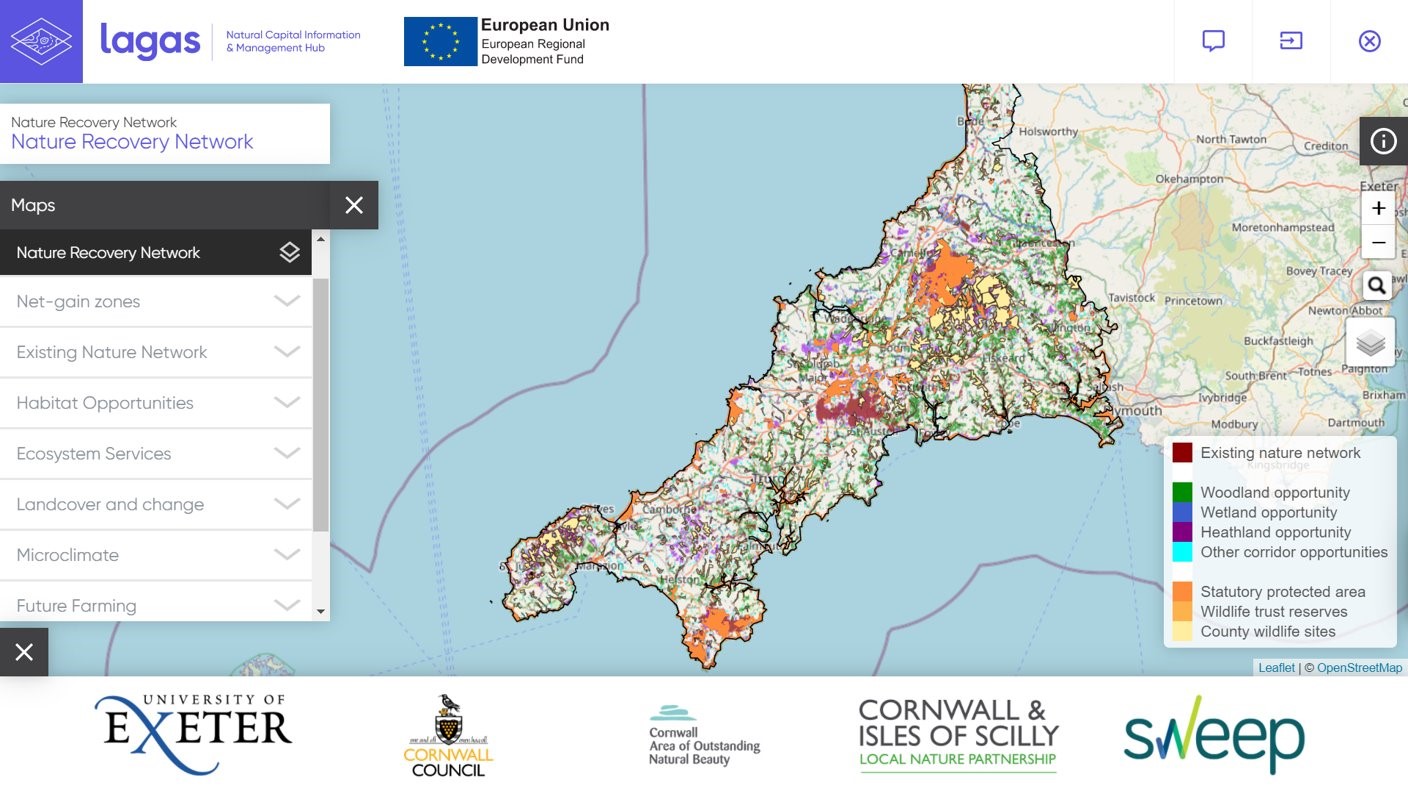
Lagas, Cornish for eye, is an online hub of environmental intelligence using the latest technology in sensor networks, mapping software and live wildlife cameras positioned within the premises of partner businesses.
The project, which brings together cutting-edge University of Exeter research alongside the work of Cornwall Council and Cornwall Wildlife Trust, makes a wide range of environmental data publicly available and fully accessible that can then inform decision-making processes.
Lagas is headed up by the Tevi programme, part of the University of Exeter’s Institute of Cornish Studies.
The project is already live, with launch events to herald the arrival of the site now well underway.
Sessions have been provided by Dr Stephen Lowe and Dr Ed Glücksman of Tevi, alongside Dr Jonathan Mosedale of the SWEEP project.
Tevi has been able to provide sessions to Cornwall Council and Cornwall Wildlife Trust in the use of Lagas.
Commenting on how Lagas will inform decisions on natural capital assets, Philippa Hoskin, from the Environmental Growth Team at Cornwall Council, said: “The Lagas natural capital tool provides invaluable new information which will be used by Cornwall Council staff when making decisions on planning, nature protection and recovery.
“The work of the Tevi team in delivering this environmental intelligence platform will positively impact nature protection and regeneration and will encourage environmental growth for years to come.”
The sessions were followed by a workshop provided to Cornwall Wildlife Trust, introducing Lagas to staff members and trustees held remotely via Teams.
Tom Shelley, conservation manager from the Cornwall Wildlife Trust, said: “We were pleased to contribute to the production of Lagas, via the Environmental Records Centre for Cornwall and the Isles of Scilly. This new system will be used to inform environmental partnership projects and statutory decision making across Cornwall.
“As well as highlighting environmental areas to protect, Lagas spatial datasets provide powerful tools to influence crucial environmental investment in the delivery of nature’s recovery. We need everyone to invest in the environment as a priority – in order to see a wilder Cornwall in the future.”


