A Cornish company is launching an iPhone app to enable sea anglers to locate the UK’s best sites from which to cast off.

AppFuture, based at the Tremough Innovation Centre, has developed Wreckfinder with the aim that anglers will be able to fish above some of the thousands of shipwrecks that can be found along the British coastline.
It has been developed with assistance from the United Kingdom Hydrographic Office, using its unrivalled records of where wrecks are sited.
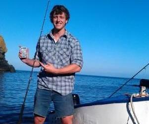
Its creator, Sean Nuzum, himself a keen angler, explained: “Fish like wrecks and so do anglers because they tend to catch more fish over them. The problem has always been locating the wrecks, as their positions have often been a closely guarded secret.
“Our app gives the location of every wreck in British and Irish coastal waters, which will provide many people with their first opportunities to fish in some highly productive areas.”
Wreckfinder uses GPS technology to map the user’s current location and the position of their nearest wreck, meaning a mobile phone signal is not essential. It then provides full details of the wreck, including its length and the depth at which it is sitting on the seabed.
Nuzum came up with the idea after he became frustrated with off-the-shelf GPS devices, that he felt both lacked detail and information, and often boasted a ‘clunky interface’.
He said: “I thought: wouldn’t it be easier to just have an app that would allow me, and others, to quickly and easily obtain wreck information to do what we love – which is catch great fish.
“I used the application in a fishing competition at Cadgwith this month and it helped me locate the Bellucia, a World War I wreck that lies just off The Lizard – and I caught a large conger eel as a result!”


